On this page
Attachments
Attachments allows users to associate nongeographic data to spatial data. Sweet for ArcGIS supports adding, viewing and deleting attachments.
To get started with attachments, make sure the feature layers have attachments enabled, see help on how to enable attachments within ArcGIS Online and Portal for ArcGIS.
Once attachments are enabled on the layer, attachments can be enabled in Sweet.
- Open the Data Rules Editor.

- In the Data Rules panel on the left hand side, select Data.
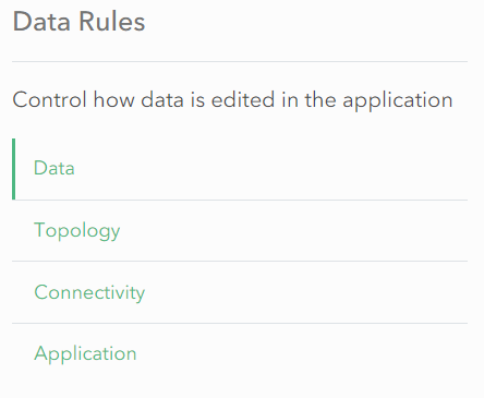
- Select the layer and open Editing.

- Switch Enable attachments for this layer on.
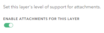
- Choose whether a user can view attachments.

Add and delete attachments
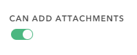
To enable the ability for users to add and delete attachments, an attachment feature service must exist. These are optional and are not dependant on one another.
- Enable Can add attachments.
- Enable Can delete attachments.

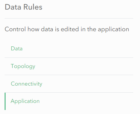
- In the Data Rules panel on the left hand side, select Application.
- An attachment feature service must be added for attachment add/delete operations to function correctly. Select either Choose or Create. For Create, it will create a new feature service in the portal.
- If using Create, enter in the Name, Tags and optionally Summary. Select an appropriate folder.
- If using Choose, search for an existing attachment feature service.
Domains
Domains are a capability in the ArcGIS system, which allow you to specify a list of values for a field. This ensures the end users can only select a value from the list.
Domains are configured in your data model either in ArcGIS Pro or ArcGIS Online/Enterprise.
Sweet for ArcGIS will automatically use any domains that you have configured in your data model.
It is possible to use attribute rules to further refine the behaviour of domains.
Conditional Domains
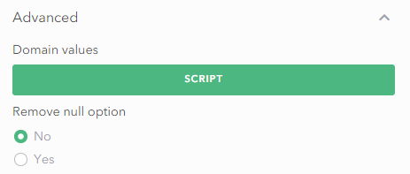
In Sweet for ArcGIS you are able to limit the choices a domain list may show to an end-user based on your own logic. This allows you to hide certain values, based on other attributes of a feature.
This behaviour is supported in Sweet for ArcGIS for fields which have domains.
This functionality is configured as an Advanced Attribute Rule via an Arcade Script. The script can return a valid array of choices to limit the selection to, or can return null to indicate that the full choice list should be returned.
An example script can be found in the attribute rules page.
Null values
Sweet for ArcGIS also allows you to make domain attributes non nullable, once they have a value. This allows a feature, when first created, to have a null value. Once it has a value, the user will only be able to configure the value from the list, and not set it back to null.